In Castejón de Sos
A favorite destination for both domestic and international flying, there are more than 15 takeoffs of varying altitudes scattered throughout the valley.
We have slopes ranging from 12m to 1400m and access to the closest ones varies from 5 min to 45 min for the furthest ones.
Takeoffs
- Height 1,200 m
- Landing 900
- Slope 300 m
- Orientation: SW
- Coordinates: 31T 294782E / 4711069N
- Landing Distance Landing Distance 1.2 km
- Date of use: All year round.
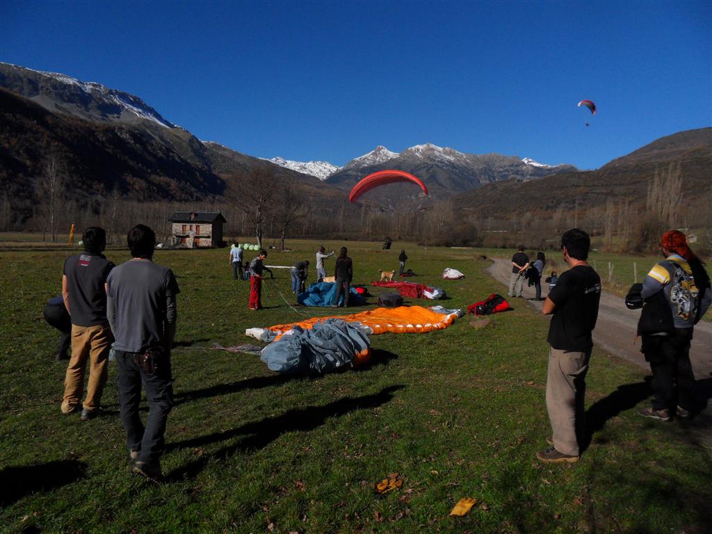
It is the second most used takeoff after Liri. If there is no breeze the flight is of short duration, but with good conditions it is possible to fly back to Liri. Easy on grass. It is possible to land again at takeoff, medium difficulty. In the middle of the day the breeze can be very strong. Little permissive with crosswinds, dangerous takeoff. From Castejón de Sos, 4 km, paved road. The road leaves just in front of the small hermitage, 8′ on foot flat.
- Height 1,200 m
- Landing 900
- Slope 300 m
- Orientation: SW
- Coordinates: 31T 294755 E / 4710813 N
- Landing Distance Landing Distance 1.2 km
- Date of use: All year
This take-off is widely used by schools. With little wind it takes off better than Rials. Also with strong wind, it is always less strong than Rials. If there is no breeze the flight is of short duration, but with good conditions it is possible to fly back to Liri. Easy on grass, important slope. Less affected by crosswinds than Rials. From Castejón de Sos, 4 km, paved road. The road leaves just in front of the small hermitage, 8′ on foot on flat terrain.
- Height: 2,090 m
- Landing: 900
- Elevation gain: 1190 m
- Orientation: SW
- Coordinates: 31T 297848E/ 4711370N
- Landing Distance Landing Distance 4.2 km
- Dates of use: May to November, outside these dates access is difficult due to snow.
- Grass takeoff, not very homogeneous.
-
Pedras Blancas was formerly the queen takeoff in the area but now it is rarely used, since the Liri takeoff is better and easier. Although when the access to Liri has snow or in the upper takeoffs there is no visibility it is the only option to go out with a drop of more than 1000m.
- Be careful in the middle of the day there can be very strong thermal conditions and the thermal comes out just in front of the takeoff.
- It is also possible that on take-off there are good conditions and on landing there is a strong breeze or different conditions.
- From Castejón de Sos, 17 km, of which 4 km are asphalted and 13 km of track in fair to bad condition.
- Access time 45mn in 4×4 or van, it is not recommended to go up with a car.
- Height: 2,250 m
- Landing: 900m
- Elevation gain: 1350 m
- Orientation: SE, SW and NE
- Coordinates: 31T 298321E/ 4712184N
- Landing Distance Landing Distance 4.8 km
- Dates of use: May to November, outside these dates access is difficult due to snow.
- This take-off is truly versatile, as it covers almost all wind directions that can be encountered.
- Grass and large in any orientation.
- Widely used in the mornings, when the breeze has not been defined.
- Be careful, when taking off to the NE, it is likely that in the valley there will be wind from the North and it can be dangerous.
- With an established breeze, the dominant and healthiest wind is from SW, if it is strong or from any other direction, it can be dangerous.
- From Castejón de Sos, 18 km, of which 4 km are asphalted and 14 km of track in fair to bad condition.
- Access time 45mn in 4×4 or van, it is not recommended to go up with a car.
- You have to walk downhill for about 5 minutes.
- Height: 2,090 m
- Landing: 900 m
- Elevation gain: 1900 m
- Orientation: ESE
- Coordinates: 31T 297972E/ 4711400N
- Landing distance 4.3 km
- Dates of use: May to November, outside these dates access is difficult due to snow.
- Widely used in the mornings when the first hillside breezes come up.
- Comfortable grass take-off, but do not rush the race too much, as the grass ends and there are stones.
- With strong easterly winds, pay attention to takeoffs, strong dynamic lift, and the mountain in front causes turbulence. Advisable in these conditions not to drift to the West.
- From Castejón de Sos, 17 km, of which 4 km are asphalted and 13 km of track in fair to bad condition.
- Access time 45mn in 4×4 or van, it is not recommended to go up with a car.
- Height 2,100 m
- Landing 900
- Elevation 1100 m
- Orientation: NO
- Coordinates: 31T 297756E / 4711562N
- Landing Distance Landing Distance 4.1 km
- Dates of use: May to November, outside these dates access difficult due to snow.
- Grass takeoff.
-
- Make sure that the breeze in the valley is from the south, if it is from the north it can be dangerous.
- There may be a light breeze from N-NW and in the valley a strong breeze from N
- From Castejón de Sos, 17 km, of which 4 km are asphalted and 13 km of track in fair to bad condition.
- Access time 45mn in 4×4 or van, it is not recommended to go up with a car.
- Takeoff: 1,720 m
- Landing: 900
- Elevation gain: 820 m
- SO Orientation
- Coordinates: 31T 296765E/ 4711565N
- Landing distance 3.2 km
- Dates of use: March to December, outside these dates access difficult due to snow.
-
Grass take-off, but which forces take-off in a very specific direction. It is not possible to make a long take-off run, as the low take-off slope would impede the take-off.
- The wind orientation must be perfectly aligned, otherwise take-off becomes difficult and undesirable.
- The most frequent use is when the wind on the upper takeoffs is strong or when access is difficult due to snow.
- From Castejón de Sos, 15 km, of which 4 km are asphalted and 11 km of track in fair to bad condition.
- Access time 30 min in 4×4 or van, it is not recommended to go up with a car.
- Height 1,250 m
- Landing 900 m
- Elevation difference 450 m
- Orientation: NE
- Coordinates: 31T 292118E/ 4711258N
- Landing distance El Raso 1 km
- Dates of use: all year round.
- Easy with carpet, but with a steep slope and little space to take off.
- If the glider is not inflated in the first steps, you must stop.
- It is only flown in the mornings, but from very early in the morning there are usually conditions to take off. Around midday the valley breeze starts to come in, and the queue is set.
- Little used but very frequented by schools.
- The landing is always made in the Raso, since the Lleva is too far away.
- It is dangerous to take off with a northerly wind, even if it is facing north, the flight can be very turbulent and dangerous.
- From Castejón de Sos 5 km of road and 600m of track in good condition.
- Height: 1430 m
- Landing: 1120
- Elevation gain: 310 m
- Orientation: SW
- Coordinates: 31T 297851E / 4719557N
- Landing distance gas station meadow 1.37 km
- Distance landing meadow hotel Benasque 1 km
- Dates of use: Restricted flight from January to mid-July not to climb more than 200m, due to the nesting of the Bearded Vulture.
- It is an underused takeoff and lacks maintenance.
- Easy on grass but with a rather gentle slope.
- At midday the breeze can be stronger than in Castejón de Sos, as the valley narrows at that point.
- Not very permissive with crosswinds, dangerous take-off
- From Castejón de Sos, 19 km, paved road. The access path leaves just after passing the bridge.
- Height: 742 m
- Landing: 519 m
- Elevation gain: 223 m
- Orientation: SO
- Coordinates: 31T273130E /4670522 N
- Landing distance o.9 km
- Dates of use: Flies all year round.
-
The takeoff from El Grado has a gentle to moderate slope. At midday the wind can get strong to very strong, less likely but even in winter.
- The most common flight is from the slope where you can take advantage of almost the entire length of the slope, about 2.6 km.
- It is accessed from the north side of the mountain range by a track in poor condition that leads to the takeoff.
- Takeoff almost impracticable to the N. Be careful in these conditions because of the sudden increase in wind intensity.

- Height: 2,300 m
- Landing: 900 m
- Elevation gain: 1400 m
- Orientation: SO
- Coordenadas: 31T299043E/4711961N
- Landing distance 5.5 km
- Dates of use: May to November, outside these dates access is difficult due to snow.
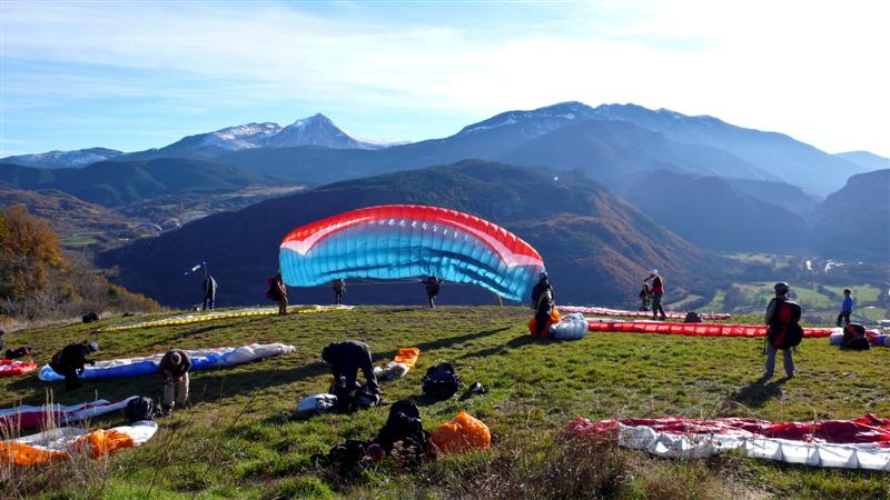
- Liri is the queen take-off of Castejón de Sos, it is the most used. Immense grass.
- Be careful, in the middle of the day there can be very strong thermal conditions, especially in summer.
- It is also possible that at take-off there will be good conditions and at landing there will be a strong breeze.
- With North wind only take off in light conditions and that you know the wind on landing. North wind can increase unpredictably and be dangerous.
- From Castejón de Sos, 19 km, of which 4 km are asphalted and 15 km of track in fair to bad condition.
- Access time 45mn in 4×4 or van, it is not recommended to go up with a car.
- Landing 900 m
- Elevation 860 m
- Take-off of grass is usually done mainly in the morning, since at midday the breeze causes the wind to come at 90º with respect to the slope.
- 5 mn access on foot, steep slope.
- Easy take-off with room for about 2 paragliders.
- You can land in front of the hotel «La Casa del Rio», but the most common is to go to the landing of «El Raso», attention is far away and to arrive with paragliding margin fineza 7.5.
- Be careful with the power line to be flown over, the upper cable is the thinnest and the least visible.
- There are many alternative meadows in case the official landing is not reached.
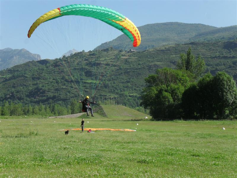
- Height 917
- Landing 905
- Slope 12 m
- SE Orientation
- Coordenadas: 31T293067E/47311308N
- Dates of use: All year round, even in snow.
-
- Small artificial hill used to simulate and train takeoffs and landings, although schools are the ones who use it the most, it is open to the general public.
- The upper part has metal tubes that prevent the paraglider from dragging the pilot downwind in strong winds.
- Located at the northern head of the airfield, subject to the breeze regime, in the morning the wind can come from behind or from the sides until the breeze is defined.
- The school slope of Castejon de Sos is one of our achievements, of a project presented to the city council and built for the enjoyment of all.
- From Castejón de Sos, 2.8 km, of which 1.3 km are asphalted and 1.5 km of track in good condition for all types of vehicles, on foot 15min.
- Height 1,630 m
- Landing 700
- Elevation 930 m
- Orientation: S
- Coordenadas: 31T286710E/4702037N
- Landing distance Field 3.3 km
- Dates of use: May to November, outside these dates access is difficult due to snow.
-
- Sometimes the all-terrain vehicle is compulsory for the maintenance of the track. Very rocky terrain.
- Immense grass and hedgehog takeoff.
- Be careful in the middle of the day there may be strong thermal conditions combined with strong wind on the ridge.
- It is also possible that at take-off there will be good conditions and at landing there will be a strong breeze.
- Good restitutions in summer. Very nice and easy afternoon flights.
- At the top there is a complex of antennas and an unobtrusive power line to the right.
- The Campo landing is far away, be careful not to stay too low as you will not reach it, although there are alternative meadows.
- There is a high tension line without electricity just arriving to the valley, normally it is overflown with altitude.
- Unique takeoff in the Campo area
- From Castejón de Sos, 20k in total of which 12 km are road and 10 km of track, all in fair to bad condition. It is not advisable to go up with a car.
- Height 1,920 m
- Landing 900 m
- Elevation 1020 m
- Orientation NNE
- Coordinates: 31T 289175E/ 4715062N
- Landing distance El Raso 5.6 km
- Takeoff of very large grass, which is usually done mainly in the morning, since at noon the breeze causes the wind to come at 90 degrees to the slope. In addition we will have the wind in front of us with the breeze installed.
- Very easy take-off.
- You can take off from the trough itself, but it is advisable to walk up about 10′.
- If we go well in altitude we pass either in front or above the takeoff of Bordas, if we pass clearly below it is possible that we do not reach the landing of the Raso which is quite far away, although it is the usual for this flight. You can land in front of the hotel «la Casa del Rió″.
- Be careful with the power line to be flown over, the upper cable is the thinnest and the least visible.
- There are many alternative meadows in case the official landing is not reached.
- With a northerly wind, it may be head-on, but it will be a turbulent and dangerous flight. Not taking off is the smartest thing to do.
- From Castejón de Sos 5 km of road and 8 km of track, in fair to bad condition.
- Access time 35mn in 4×4 or van, it is not recommended to go up with
- Access time 40 min in 4×4 or van, it is not recommended to go up with a car. From 0 to 15′ min on foot from the watering place.
- Height: 2,330 m
- Landing: 900 m
- Elevation gain: 1430 m
- Orientation: SO
- Coordenadas: 31T298205E/4714386N
- Landing distance 6 km
-
-
Dates of use: It is accessed through the ski resort of Cerler is in the season that is open, usually from the last weekend of November until the end of April. The Cogulla take-off has a moderate to steep slope. From February we can have good thermal conditions but with cold. You can not take off with wind from the N. Remember that you can only access the takeoff with skis, if there is no snow in the valley does not matter, you land very comfortable on the grass of the official landings and are not damaged. Always contact Tandemteam if you are interested in flying.
Free access.
-
- Height: 2,305 m
- Landing: 900 m
- Elevation: 1405 m
- Orientation: SO
- Coordenadas: 31T297753E/4714725N
- Landing distance 6 km
Dates of use: Access through the ski resort of Cerler is in the season it is open, usually from the last weekend of November until the end of April.
Takeoff with gentle to moderate slope. From February onwards we can have good thermal conditions but with cold. The ULM landing strip is used, which is located outside the ski area of the ski resort.
It is not possible to take off with wind from the N.
Remember that you can only access the take-off with skis, if there is no snow in the valley it does not matter, you land very comfortably on the grass of the official landings and they are not damaged.
Always notify Tandemteam if you are interested in flying. Free access.
- Height 1,180 m
- Landing 915 m
- Elevation 265 m
- Orientation: SO
- Coordenadas: 31T294817E/4710710N
- Landing Distance Takes 1 km
- Takeoff in disuse, and that when building the New Rials takeoff, since the new one is much easier and with more possibilities.
-
- Grass takeoff but short.
- It is not possible to land on takeoff.
- Be careful in the middle of the day there may be strong wind. Take off with abrupt cut. With strong and light wind it is technical.
- 5km road and 10mn walking
- Height: 2,280 m
- Landing: 1120 m
- Elevation gain: 1160 m
- Orientation: NNE
- Coordenadas: 31T297321E/4714881N
- Landing distance Prado gas station Benasque 4.8 km
Takeoff with moderate slope. It is possible that in the valley there is wind from the N and it is dangerous, be sure before taking off from the wind in the valley.
Remember that you can only access the take-off with skis, if there is no snow in the valley it does not matter, you land very comfortably on the grass of the official landings and they are not damaged.
Always notify Tandemteam if you are interested in flying. Free access.
Landings in Castejón de Sos
Although we indicate the orientations of the fields, what predominates is the direction that the valley forces the wind, i.e. from SE to NW or vice versa.

- Dimensions: 600m x 100m
- Height: 905 m
- Orientation SE – No
- Extremely large and easy landing.
- In the mornings the wind usually comes from NW until the SE breeze begins to predominate, and in the afternoons the SW breeze reverses and becomes a descending NW wind.
In the hours of maximum sunshine in summer there can be strong breezes of more than 30km/h. Of the landings in Castejon is the one with the strongest wind always.
Beware of the North Wind that is channeled and is the first Landing to be affected.
In Castejon the airspace is shared with ultralights, the coexistence is good and positive, but to keep it that way, some rules must be respected.
-
- The landing of «El Raso» where the ULMs take off/land, is leased by them, and you allow us to land the paragliders, let’s not be rude.
- In ULM landing, do not fold in the middle of the runway, only on the sides.
- Do not make abrupt maneuvers during landings; we must be predictable for other aircraft.
- Do not land with the gliders in the middle of the runway, and only in case it happens, pick up the glider and move to the sides.
- Be careful when crossing the runway, modern ULMs hardly make any noise. Always look before crossing.
- Respect livestock and uncut grass. Beware of electric herders.
- From Castejón de Sos, 2.3 km, of which 1.3 km are asphalted and 1 km of track in good condition, for all types of vehicles.
- Dimensions: 150m x 50m
- Height: 910 m
- Orientation: SE – NO
- Coordenadas: 31TE293809E/4710419N
- Dates of use: All year round, even with snow.
- It is the smallest landing of Castejón de Sos but covered with a nice grass all year round.
- When the wind is strong, it is the place where it registers less intensity.
- It is surrounded on the N and E by a 1.5 m fence that separates the track from the other meadow «El Ral».
- Beware of very tight approaches and the wind gradient that can play a trick on our calculations. In case of a very tight approach we land at the «El Ral» stop to the N.
- In fact the meadow «El Ral» can be used as an alternative landing.
- Respect livestock and uncut grass. Beware of electric herders
- From Castejón de Sos, 2.3 km, of which 1.3 km are asphalted and 0.5 km of track in good condition, for all types of vehicles. You can walk to the village by road for 5′ min.
- 900 m 5′ walk from Castejon de Sos Easy on grass Respect cattle and uncut grass. Beware of electric shepherds
Other landings
- Prado Gas Station:
-
- Dimensions: 260m x 100m
- Height: 1120 m
- Orientation NE – SW
- Coordenadas: 31T296442E/4719424N
- Prado Gran hotel Benasque:
- Dimensions: 200m x 70m
- Height: 1130 m
- Orientation NE – SW
- Coordenadas: 31T296809E/4719429N
- Dimensions: 200m x 100m
- Height: 700 m
- Orientation NE – SW
- Coordenadas: 31TE286113E/4698848N
- Dates of use: All year round.
It is a large but slightly sloping landing, do not rush it to the end because the glide is very long. Respect the seedings.
At the end of it is the town of Campo.
From Castejón de Sos 20.5 km, of which 20 km are paved and 0.5 km of track in good condition, for all types of vehicles. From the landing you can walk to the village by road 5′ min.
National and international flight zones
The best app and website where we can find almost all the flight zones worldwide, from the poles to the tropics.
It allows us to search, by town or site and gives us a location reference, usable wind direction, integration with Wndy… It is excellent.
